Completion requirements
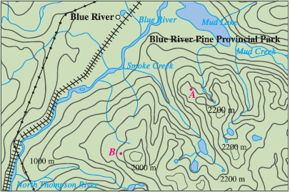
Exercise 36
Shown is a topographic map of Blue River Pine Provincial Park in British Columbia. Draw curves of steepest descent from point A (descending to Mud Lake) and from point B.